Your farm on a map that actually works offline.
Import parcels from cadastral sources across the EU, edit geometry with a finger, and carry every boundary in your pocket — even where there's no signal. The map is the home screen of your farm.
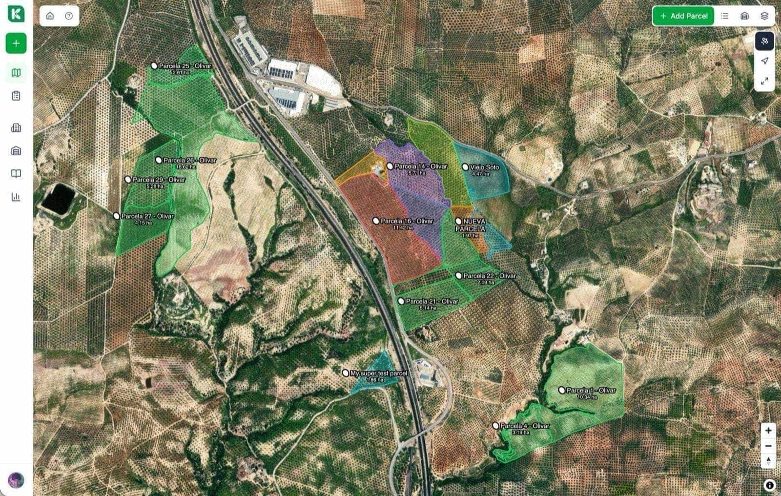
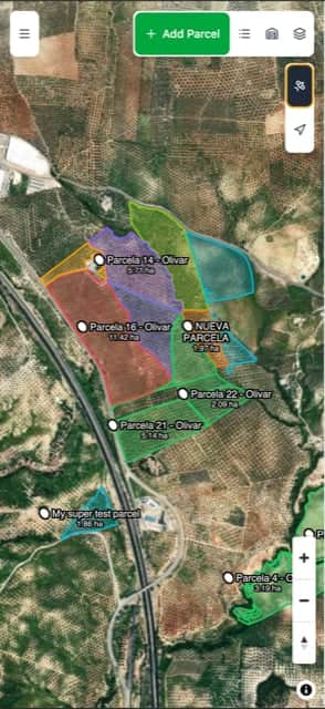
One map. Every parcel. Always with you.
Most farms still run on a patchwork of paper maps, cadastral PDFs, and half-remembered boundaries. Koru pulls every parcel onto a single interactive map that works in the browser and on mobile, online and off. Surface areas are calculated in real time, so the numbers you quote are the numbers inspectors see.
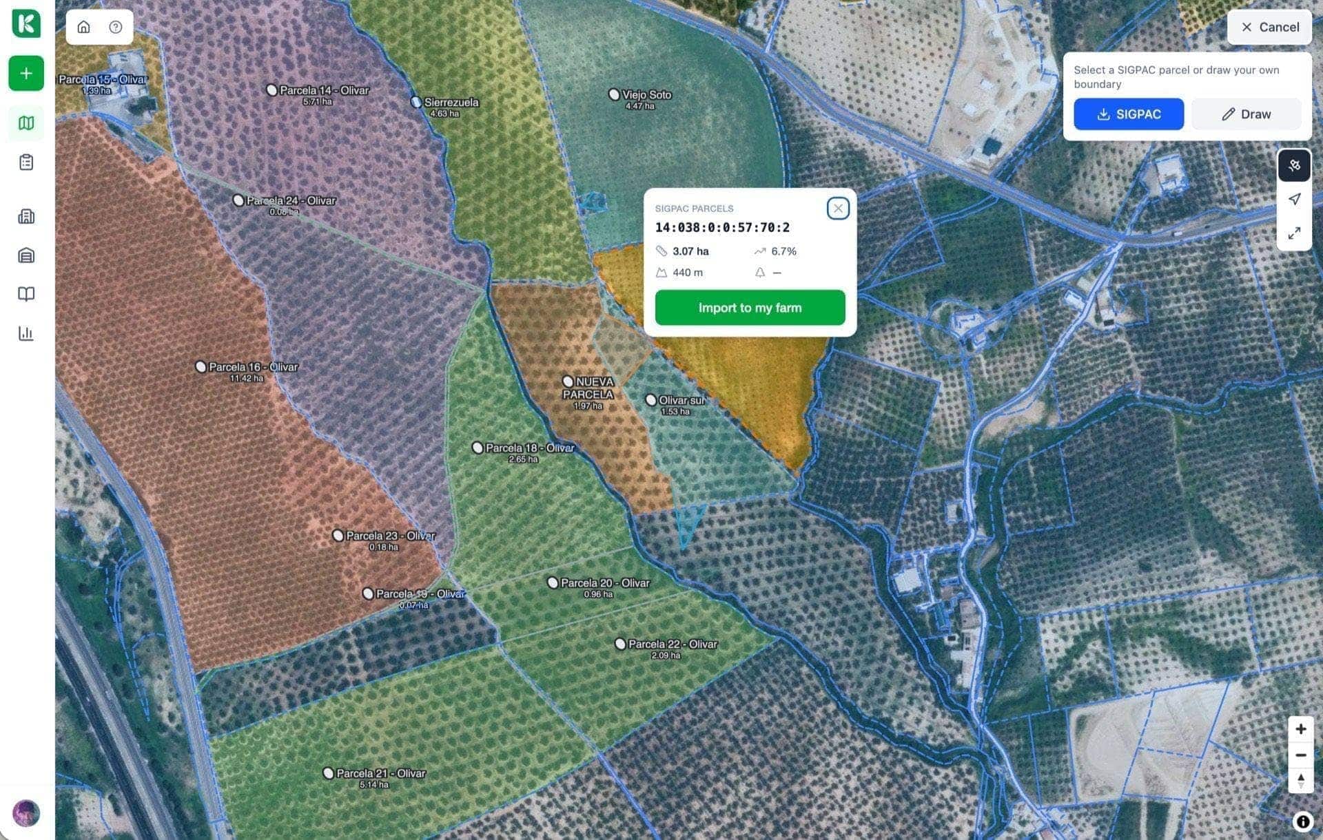
Cadastral import from across the EU.
Pull parcels directly from your national cadastral source — no manual polygon drawing, no importing shapefiles from stale backups. Every parcel lands with its official reference and its surface area already calculated. Edit the geometry only where you need to.
- Direct import from cadastral sources across the EU
- Official parcel references preserved for audit
- Automatic surface area calculation from geometry
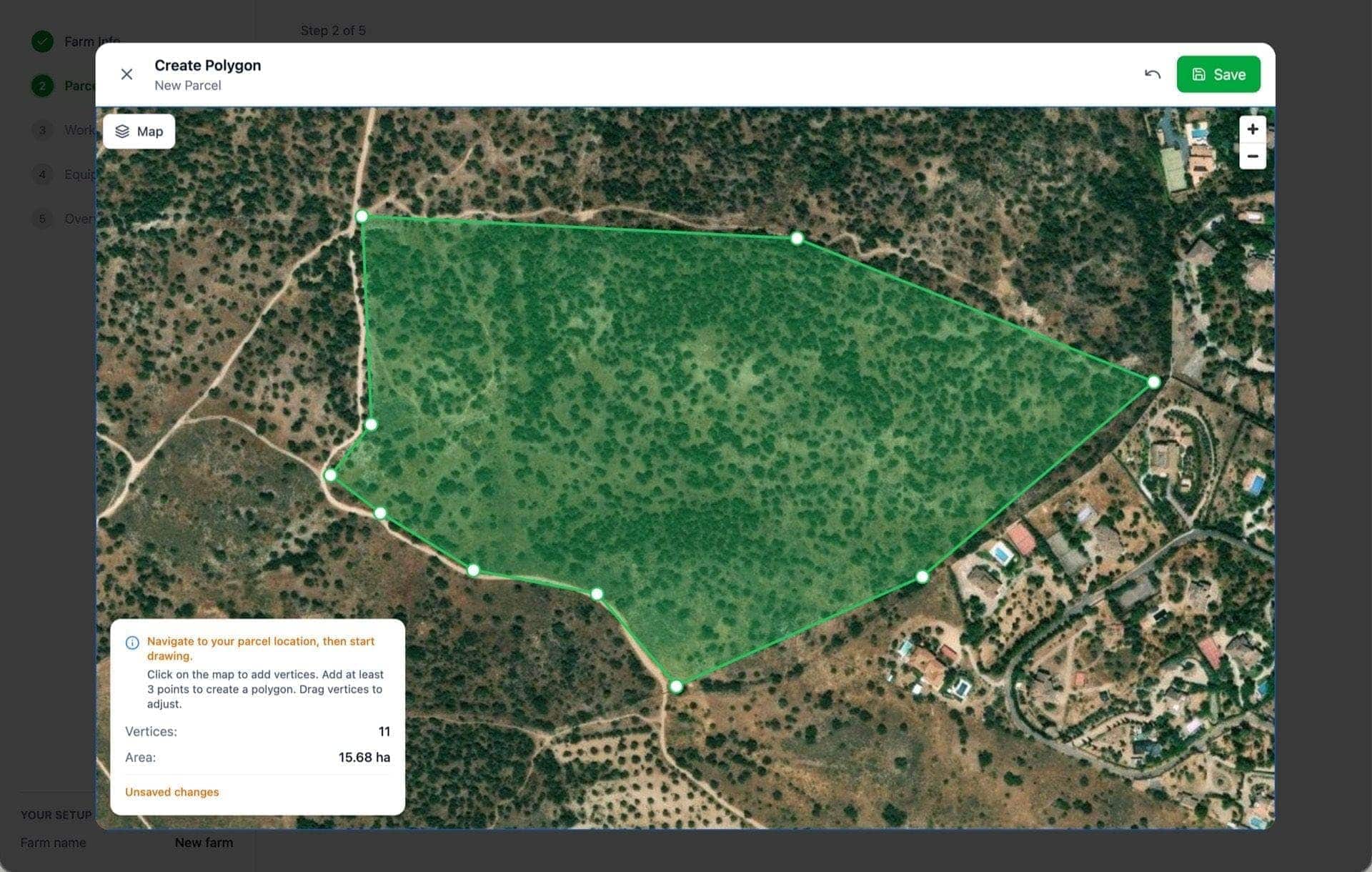
Edit geometry with your finger, in the field.
When the cadastral polygon doesn't match reality — and it often doesn't — drag the vertices with your finger. The map updates in real time, recalculates the surface area, and saves a revision so you can always see what changed and when.
- Touch-friendly vertex editing on mobile
- Split and merge parcels without losing history
- Every edit versioned with timestamp and author
Everything your parcel map should do.
Built to be the fastest path from cadastre to field-ready geometry.
Cadastral import
Pull parcels from national cadastral sources across the EU, with official references preserved.
Auto surface area
Every polygon's hectares calculated in real time — the number you quote is the number of record.
Works offline
Cached map tiles and parcel geometry let you open the map in the middle of a field with no signal.
Crop overlays
Colour-code parcels by crop, season, or treatment status at a glance.
Versioned geometry
Every vertex edit is logged with timestamp and author so you always know what changed.
Shared view
Team members see the same map state — no 'which version is this?' confusion.
Activity overlays
See treatments, harvests, and scouting events pinned to the parcels where they happened.
Export geometry
Download KML, GeoJSON, or shapefile for CAP filing, insurance, and advisor sharing.
Built for anyone who works a parcel.
- Start free
Single farm
Stop guessing surface areas from decade-old PDFs. Every parcel lives on one map, with one accurate area, accessible from the tractor.
- Ask for demo
Advisor
Advisors get instant cadastral imports for every client — no wrestling with shapefiles or asking clients to send PDFs.
- Ask for demo
Cooperative
Cooperatives can visualise every member's parcels in one place — critical for coordinating treatments, irrigation, and subsidy claims.
“I finally see every parcel in one place — with the right areas.”
Live, offline-capable, and used daily in the field.
Maps is one of the most-used modules in Koru. Cadastral sources keep expanding, offline reliability keeps improving, and every new release ships with tighter mobile performance.
Put every parcel on one map. For real.
Free 14-day trial. Cadastral import included. No credit card.
Keep exploring Koru
PAC onboarding
Your CAP declaration starts with clean parcel geometry.
Activity management
Every treatment is stamped with the parcel geometry of the day.
Reporting
Parcel-level reports built directly from the map you edit.